 |
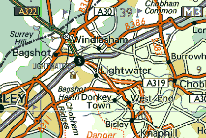
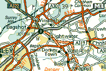
| We are
here or thereabouts: click the map for an enlarged view |
 Along
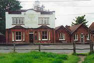
Brentmoor road is the Hare & Hounds, opposite which was WECCs' original ground. It now
forms part of the extensive Brentmoor Common, an area of lowland heath covering some 75
hectares managed by the Wildlife Trust. Read about the more historical aspects of Brentmoor Road here. Across
the A319 from Gordon's School on Windlesham Road is the excellent 9-hole Windlemere
golf course, Opposite which is Hookstone Green. In years past, on November
5th a bonfire burned here as well as on Streets Heath Recreation Ground.
A short way out of the village
along the Red Road was The Folly. This gravel pit of importance lay on the boundary
between
the parishes of West End and Windlesham and locals used it extensively for roads and other
construction work. Its location made it a point of importance when "beating the
bounds." At the end of the
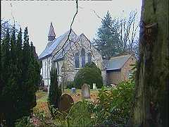
eastward-bound Beldam Bridge Road is the Castle Grove public house, apparently
originally built as a booking office for a light railway for Chobham
that never materialised. This doubtless explains why to this day the road to Woking is
named "Station Road" with no station! Along
Brentmoor road is the Hare & Hounds, opposite which was WECCs' original ground. It now
forms part of the extensive Brentmoor Common, an area of lowland heath covering some 75
hectares managed by the Wildlife Trust. Read about the more historical aspects of Brentmoor Road here. Across
the A319 from Gordon's School on Windlesham Road is the excellent 9-hole Windlemere
golf course, Opposite which is Hookstone Green. In years past, on November
5th a bonfire burned here as well as on Streets Heath Recreation Ground.
A short way out of the village
along the Red Road was The Folly. This gravel pit of importance lay on the boundary
between
the parishes of West End and Windlesham and locals used it extensively for roads and other
construction work. Its location made it a point of importance when "beating the
bounds." At the end of the
eastward-bound Beldam Bridge Road is the Castle Grove public house, apparently
originally built as a booking office for a light railway for Chobham
that never materialised. This doubtless explains why to this day the road to Woking is
named "Station Road" with no station!
The
National Rifle Association had better luck after given notice to quit Wimbledon Common in
1888. Moving onto Bisley Common, a station was opened by the then Prince Of Wales, one
month before the order was passed under the Tramways Act of 1890! (This was six
years before the Light Railways Act.) This branch line ran from Brookwood
station, ran
westward on the northern side of the Waterloo line till the bridge near Pirbright, then
curved north over the recently-restored Basinstoke Canal toward where Bisley Camp is
today, a total of about 1.25 miles in length. It served the N.R.A. every July when they
had their meetings (which continue to this day). It was used rather more heavily during both
World Wars, being extended to Army camps in the area for the duration of each breakout of
hostilities. Rarely making any profit, the branch was closed by the LSWR in July 1952, the
last journey marked by suitable music and rifle volleys courtesey of the Gloucester
Regiment. The tracks were removed shortly afterwards but the route is visible for much of
it's length for those curious enough to look. (The wartimes' extended route is much
harder to find, though.) The station buildings at the Camp are still in use, mainly for
accommodation. (Click here for Bisley Gun Club.) Nearby Brookwood (through which goes Basingstoke
Canal) houses a huge, peaceful War
Cemetery. A couple of miles away to the east of West
End you'll hit Horsell Common, famous as a setting for H. G. Wells' sci-fi classic,
"War Of The Worlds." To the east of Chobham is Fairoaks Airport.
 |
New
Website devoted to villages in
our area, including West End! |
Origins of the village Recent times &
around the area
|